Trails of the Past
Brent Wiebe
The chorus of the touching song “Wua es mien Darp?” by Fief Meniste begins with the question “Where is my village?” This is relevant not only for the visitor to his childhood home in the Chaco, as in the song, but also for thousands of other descendants of Russian Mennonites scattered around the world. Finding our ancestral village can be difficult as many of these places in Russia, Ukraine, and other locations have changed beyond recognition, been renamed, or have disappeared altogether.
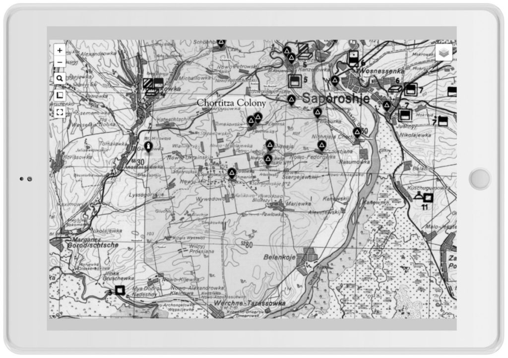
“Trails of the Past,” a project funded through a grant from the Plett Foundation, seeks to help people answer this question. One of the first objectives of the project was to compile maps from the nineteenth and twentieth centuries. The foundational layer of the Trails of the Past project is known as the Schubert maps. This highly accurate set of Russian maps from the second half of the nineteenth century contains details such as windmills, wells, and stockyards. The Schubert maps are carefully laid over newer maps and aligned with modern satellite imagery. This is called georeferencing and after processing dozens of maps and hundreds of villages, we have a large area covered, including most of the colonies settled by Mennonites in Ukraine and West Prussia. Further work is planned to include Canada, as well as Central and South America. This zoomable map is available online for free access. By entering the name of a village in the search bar online, users can easily find its location and view it in a variety maps from different eras. A similar map is also available in a mobile application for Android and iOS devices. It is designed to help travellers view their live location on old maps using the GPS on their mobile device.
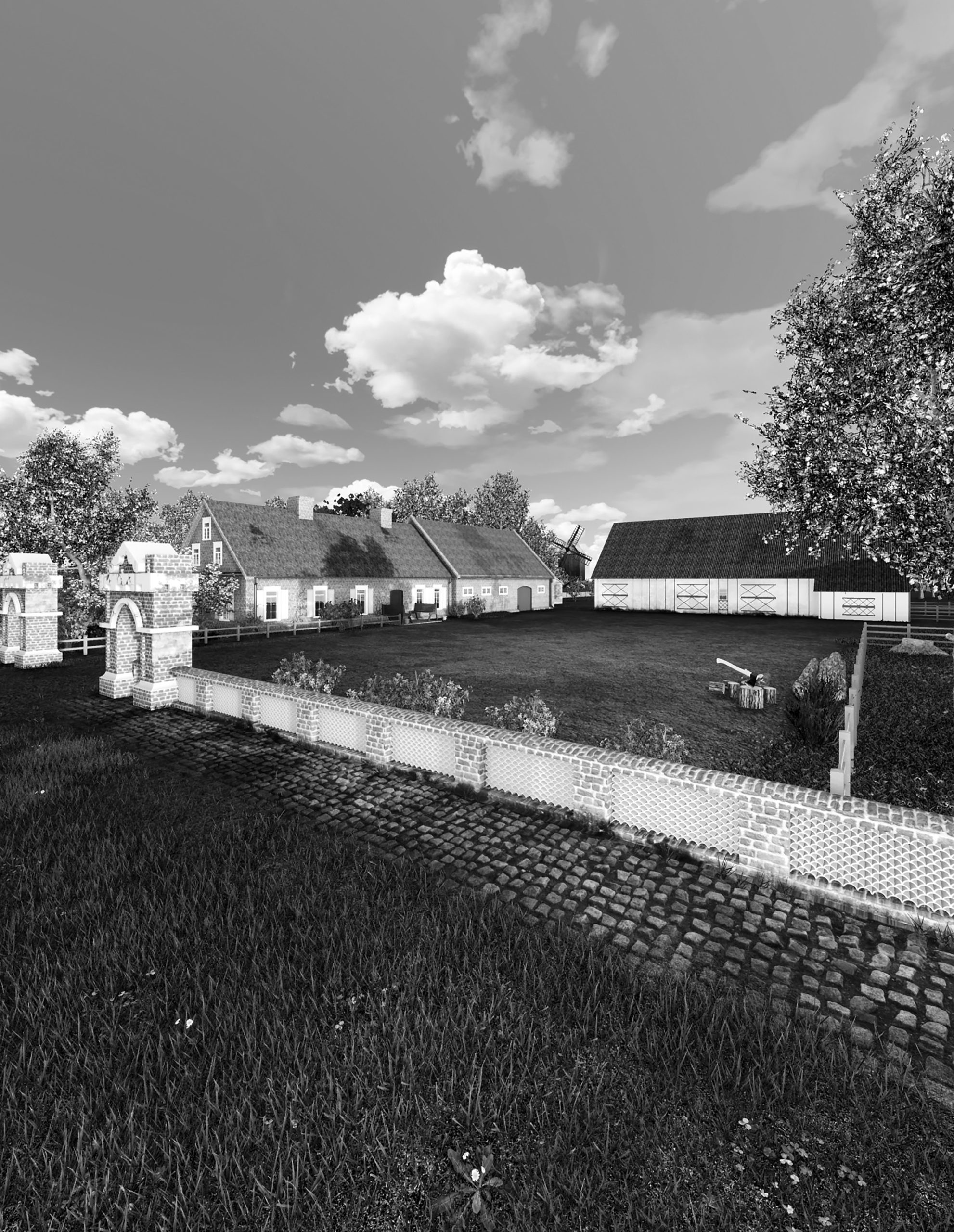
Another part of the Trails of the Past project is recreating beautiful pictures of our ancestral homes. This is done by carefully looking at village maps, old and new photographs, any available research resources, and artwork. Based again on a combination of old and new data, houses and outbuildings are redrawn in modern architectural computer programs. The next step is placing the buildings on sites created by using old village plans and topographical information. Trees, flowers, and gardens must also be located on the farmyards according to the Mennonite tradition. Some of this information is hard to come by, so any historical descriptions of Mennonite life in the 1800s are very useful to us. Nineteenth century Agricultural Society chairman Johann Cornies, for example, left specific and valuable plans on planting trees and laying out villages.
The goal of Trails of the Past is to provoke interest in young and old alike by approaching old topics from a modern perspective. A second goal of the project is to help people find and experience their village. Visit our website at www.trailsofthepast.com to find out more.